Groundsite Image Gallery
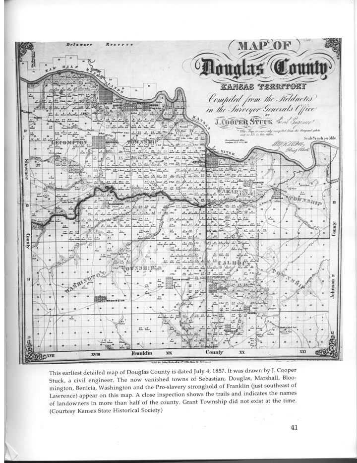
Map of Douglas County
Artist: Hughes, Langston
Height: 0.000"
Width: 0.000"
Map of Lakeview, 5.5 miles northwest of Lawrence.
This 1857 map by J. Cooper Stuck shows the oxbow loop of the Kansas River, left of center, where the village of Lakeview stood. Charles and Mary Langston, grandparents of Langston Hughes, farmed near here in the late 19th century. Charles Langston owned section 16 of the Wakarusa township of Douglas Co., which runs to the south edge of the lake.
The flat floodplains of the Kansas River are among the most fertile soils in the world.